




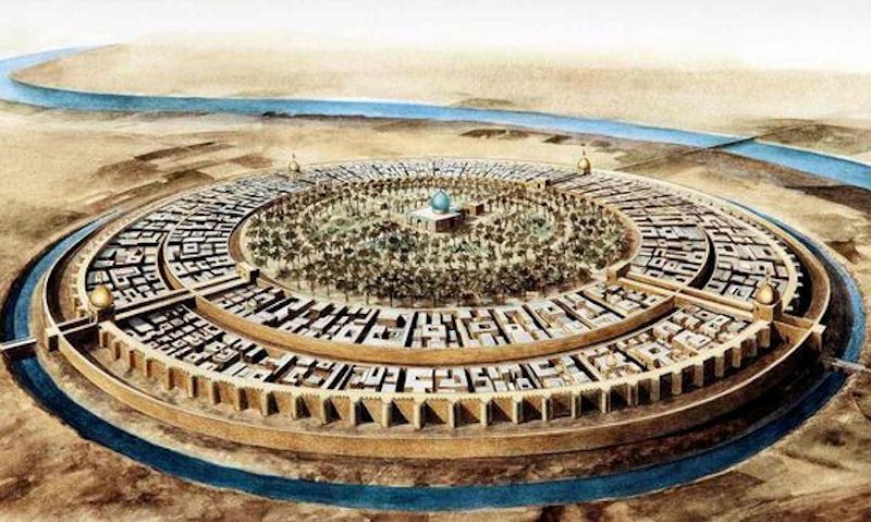
The walls of Benin remind us that the history of humanity is not limited to what we have been told. The greatest achievements of our species are not always found where we have been taught to look.
Philippe Pied
Four times longer than the Great Wall of China, a hundred times more massive than the Pyramid of Khufu: the walls of the Kingdom of Benin, built by the Edo people between the 8th and 15th centuries in present-day Nigeria, constitute the largest earthwork ever constructed before the age of machinery. Yet almost no one knows about them.
An Empire Built in the Forest
When we think of the greatest human constructions, two names immediately come to mind: the Great Wall of China and the Pyramid of Khufu. Few people would mention Benin City, and yet it is there, in the heart of the rainforest of what is now Edo State in Nigeria, that the Edo people built what may be the greatest archaeological marvel on the planet.
The Kingdom of Benin—not to be confused with the modern Republic of Benin, formerly Dahomey—emerged around the 10th century. Its capital, Benin City (then known as Edo), would go on to become one of the most well-organized and prosperous cities in the medieval world. And its city walls would shatter all records.
16,000 kilometers of walls dug by hand
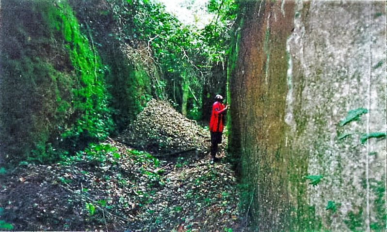
The figures are staggering. The network of walls and moats that surrounded Benin City and its environs stretched for a total of approximately 16,000 kilometers, covering an area of 6,500 km². This honeycomb-like network connected more than 500 communities, each surrounded by its own earthen embankments.
Science journalist Fred Pearce, in a seminal article published in New Scientist In 1999, it was estimated that the construction of this colossal complex required approximately 150 million hours of labor. Everything was dug by hand, without any machinery: the ditches were excavated to form moats, and the excavated earth was used to build the ramparts.
The 1974 edition of the Guinness Book of World Records had, in fact, recognized these walls as the greatest earthworks ever undertaken before the age of machinery.
Much more than just a fortification
Contrary to what one might imagine, these walls were not used solely to defend the city. Archaeological research conducted by Graham Connah and Patrick Darling in the 1960s and 1970s revealed a much more complex reality. The city’s inner walls functioned as an urban planning system, delineating neighborhoods and social spaces. The outer walls, meanwhile, played a role in political integration: by erecting their own earthworks, each community signified its allegiance to the king (the Oba).
The height of the walls varied, in fact, depending on the site’s political significance—an architectural language that made the hierarchy of power visible within the landscape itself.
A city that amazed Europeans
The first Europeans to discover Benin City were astonished. When the Portuguese arrived there in 1485, they called it the «Great City of Benin,» one of the few places in Africa that they recognized at the time as a true city.
In 1691, the Portuguese captain Lourenço Pinto provided a description that has remained famous: In his view, the city was larger than Lisbon, with perfectly straight streets stretching as far as the eye could see, vast houses adorned with columns, and such a high level of security that the residents did not even need doors on their homes. The 17th-century Dutch traveler Olfert Dapper, for his part, described houses carefully aligned along orderly streets, with red clay walls polished as smooth as chalk.
The city also had nighttime lighting provided by large palm-oil lamps mounted on pillars—a luxury that very few medieval cities could afford. Its artisans, grouped into some forty neighborhoods according to their specialties, produced, among other things, the famous Benin bronzes, which are among the most beautiful works of art ever created in Africa.
1897: Destruction by the British expedition
The fate of this marvel took a turn in 1897, when the British launched what they called the «punitive expedition.» Colonial troops destroyed much of the city’s 15-kilometer-long inner walls and looted thousands of bronze and ivory artifacts, which are now scattered throughout museums around the world.
However, the destruction was not as complete as had long been believed. A study conducted in 1964 showed that the ramparts and moats were still largely intact at that time. It was the rapid urban expansion since the 1960s that caused the most irreversible damage. Today, more than half of the original ramparts and moats surrounding Benin City have been destroyed by real estate development, as residents have used the remains as building materials.
A heritage in danger, a memory to preserve
The Benin Walls and the Eredo of Sungbo, another impressive earthwork in the region, have been on UNESCO’s Tentative List of World Heritage Sites since 1995. However, protection remains largely inadequate. Although technically protected by Nigerian law since 1961, these ruins continue to disappear under the pressure of urbanization.
Ethno-mathematician Ron Eglash has also demonstrated that Benin City was built according to fractal mathematical principles—a sophisticated urban design that early European observers were unable to recognize, mistaking the city’s layout for primitive disorder.
There is something profoundly unfair about the fact that every schoolchild on the planet knows about the Great Wall of China, while the walls of Benin—which are longer, more massive, and bear witness to a civilization of extraordinary richness—remain almost completely unknown. Perhaps it is time to rewrite the textbooks.