




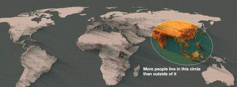
More than 50% of the world’s population lives within this circle.
Do you think it's a coincidence?

Let's zoom in on the region to analyze the situation.
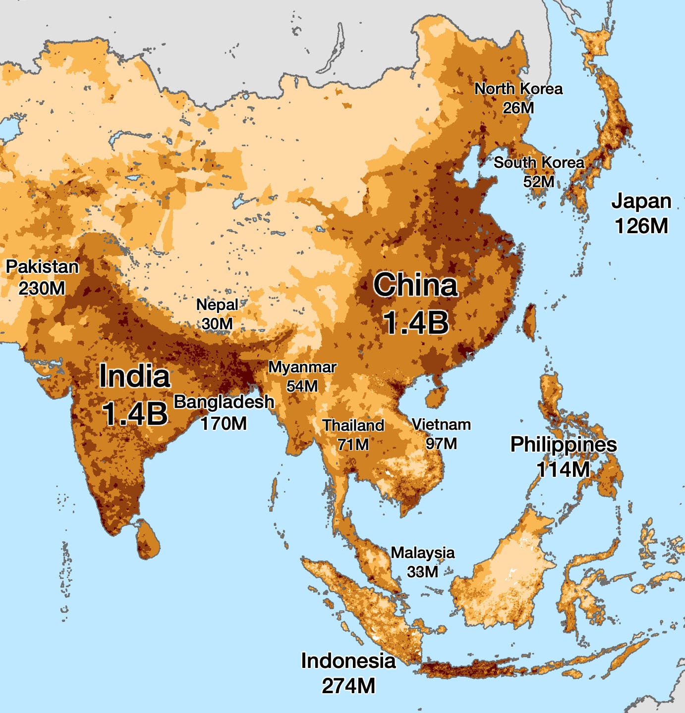
India and China together have a combined population of 2.8 billion people, or 35% of the world’s population.
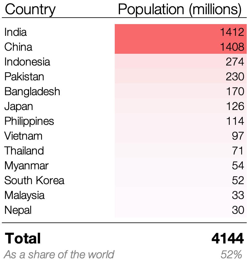
But many other neighboring countries also have massive populations: Indonesia has 274 million, Pakistan 230 million, Japan 126 million, the Philippines 114 million… And those are just the ones with over 100 million people. All these countries combined account for a little over 50% of the world’s population.
The Origins of the East and South Asian Population
Let's take a closer look at the biggest ones. First, there's India.
1. India
I conducted an in-depth analysis of India, along with Pakistan and Bangladesh, in an article about the Indian subcontinent. If you've read the article or thread, or already understand why India has such a large population, skip this section. If not, you might want to check it out now, or simply read this short version:
- The Indo-Australian Plate collides with the Eurasian Plate
2. The collision causes the land to rise.
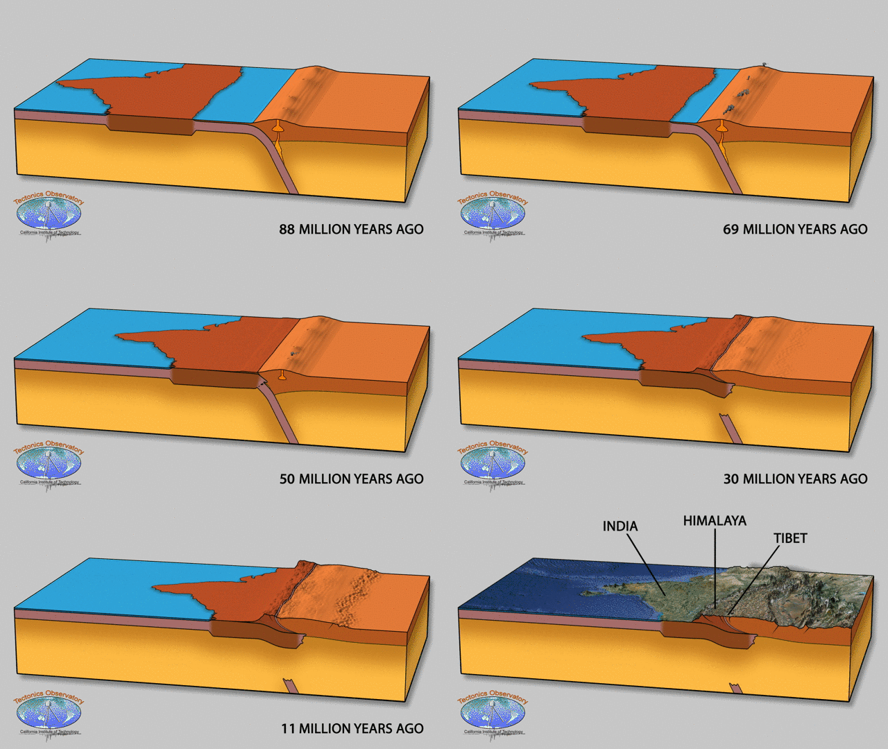
3. This creates the world's largest mountain range, consisting of the Himalayas, Tibet, the Hindu Kush, the Hengduan Mountains…
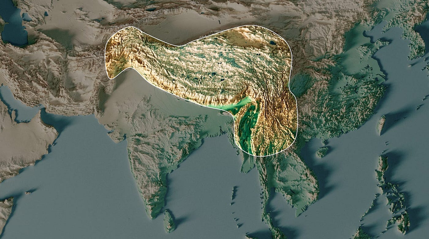
4. The weight is so great that these mountain ranges are sinking toward the Earth. The surrounding areas sink along with them, becoming flatter and forming valleys.

5. Winds carrying a lot of moisture come from the Indian Ocean, hit the Himalayas, rise, the air cools, the moisture condenses, and it rains.
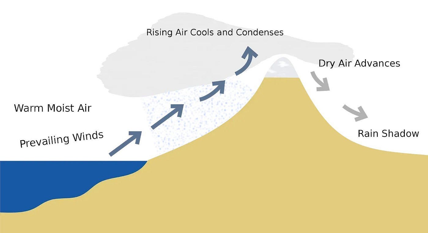
This image shows that: India is green on the left, and Tibet is dry on the right.
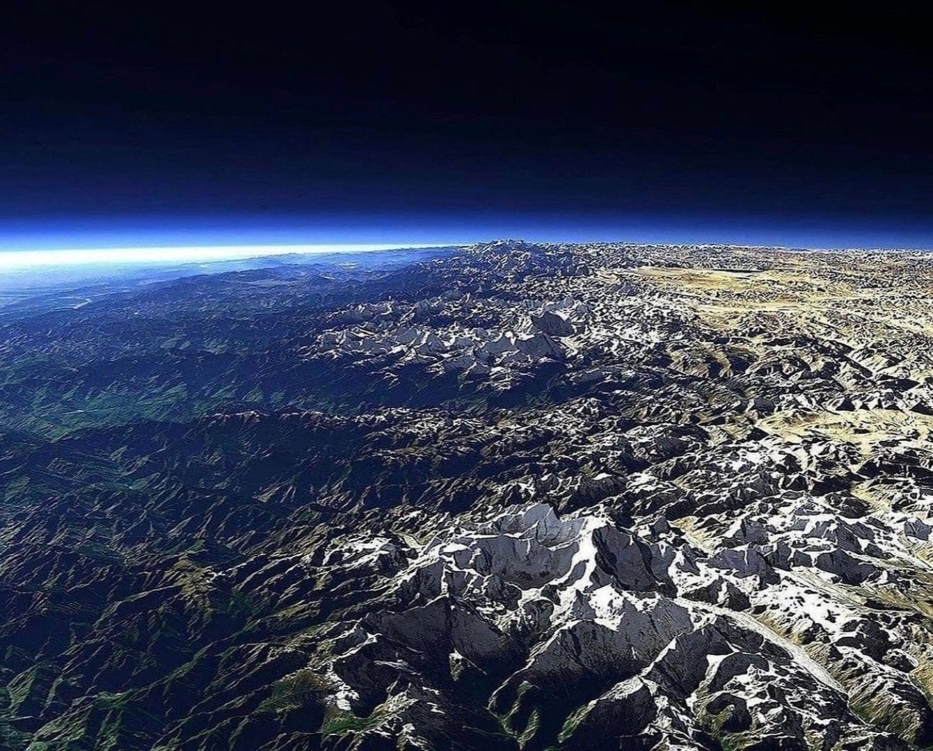
6. Some rain falls directly on India—making much of it fertile—and much of the rest falls in the Himalayas and flows downhill. All this water converges in the Ganges Valley, making it very humid and suitable for irrigation.
7. The Ganges carries sediment with it, which fertilizes the Ganges and any area it floods.
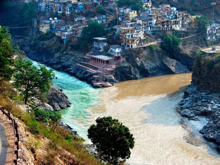
8. Rain, fertilizer, rivers for irrigation, and heat: Perfect conditions for agriculture, which makes India one of the world’s largest food producers. Food = population.

Now there’s one more thing: Why does the wind carry so much moisture into India? In this part of the world, that’s not common.

The Horse Latitudes tend to have deserts because the wind blows over the land without any water. Why?
Because of the Earth's rotation.
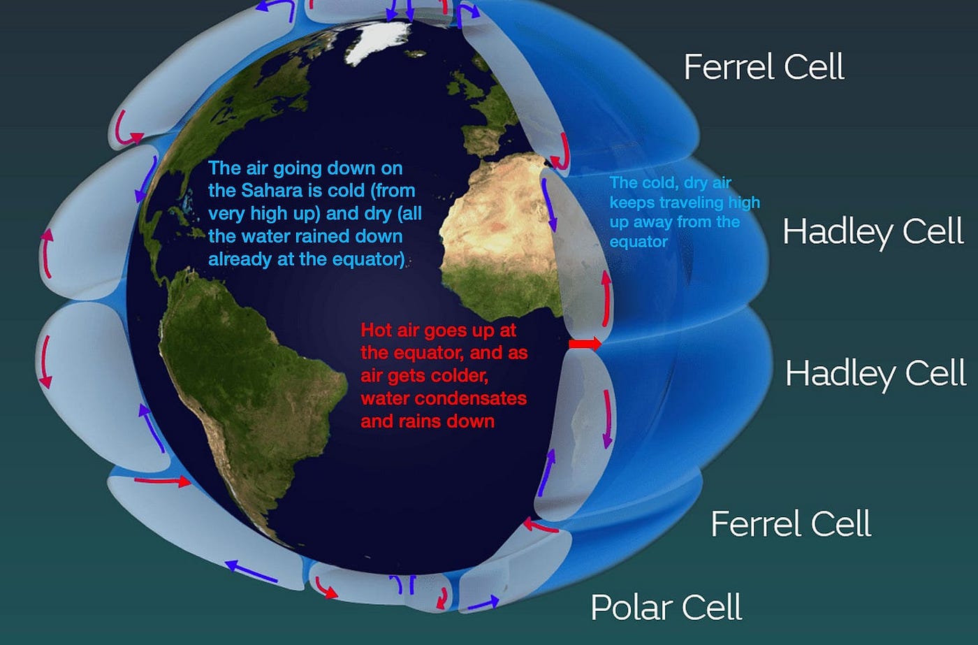
The equator is the hottest part of the world because the Sun shines directly on it. This causes water to evaporate and the air to heat up. Hot air is lighter, so it rises; when it reaches the colder air in the upper atmosphere, water condenses and falls as rain. But the air keeps flowing because of the Earth’s rotation! And it descends in the Horse Latitudes, where there is no water. With so much wind blowing downward, other winds have a hard time reaching that area, and there is no rain.
So why doesn't it work in India? Because of the monsoon.
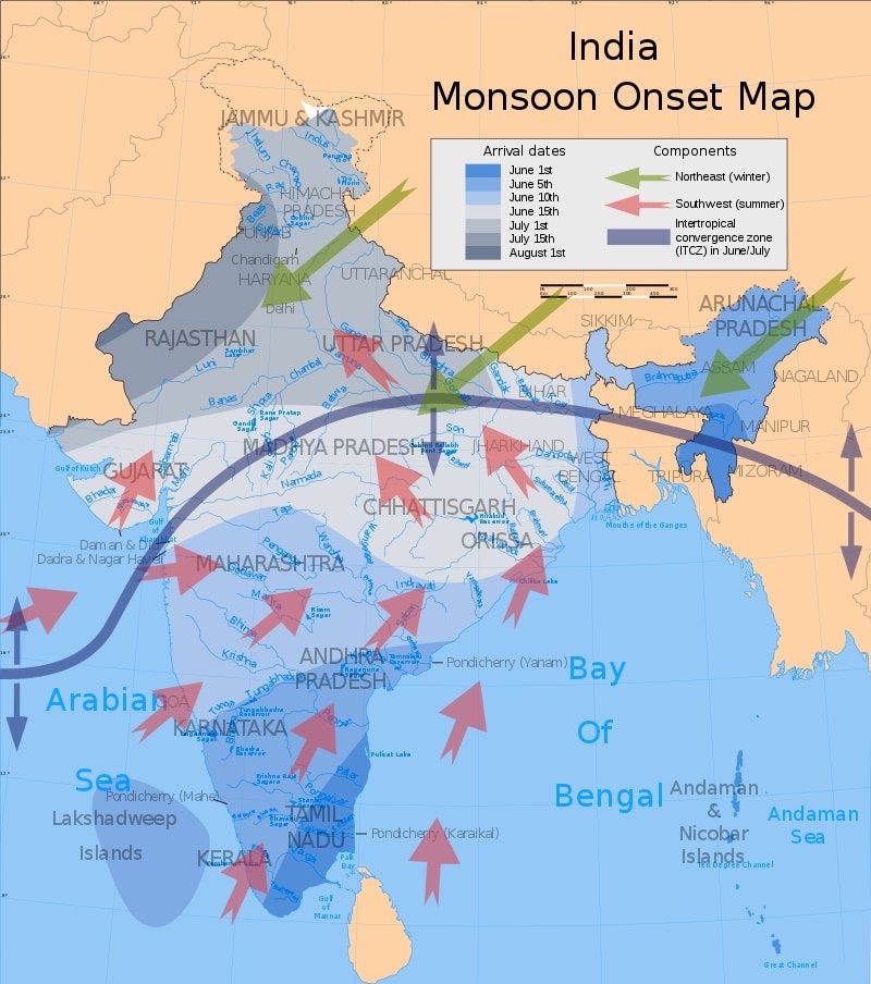
In the summer, monsoon rains overcome this mass of dry air and bring humid winds to India. How does that happen?
Because Eurasia is so big.
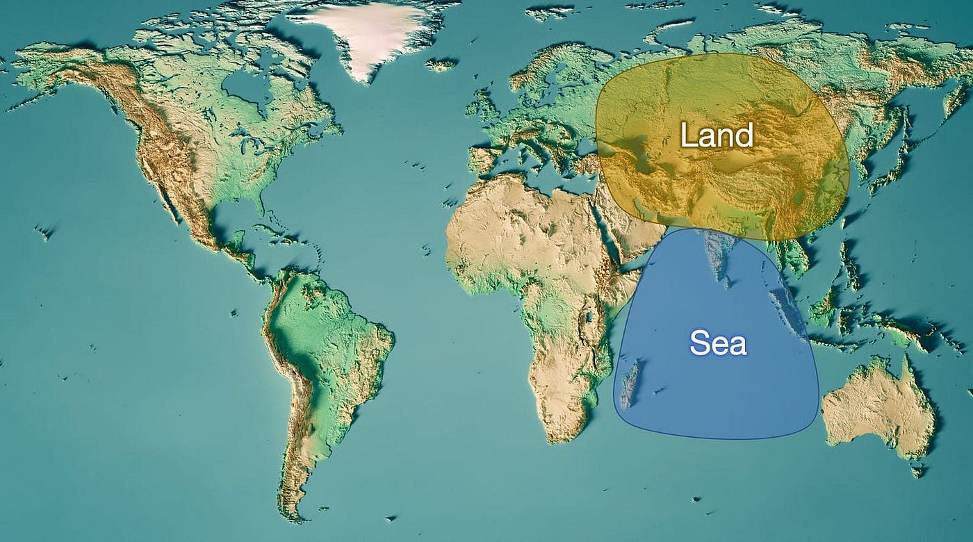
This part of the world is the only one with a southern ocean and a northern continent. Here's what happens in the summer:
- The Indian Ocean and Eurasia are heating up.
- In the Indian Ocean, this heat causes water to evaporate, and the air becomes saturated with moisture.
- But land heats up faster than water, so Eurasia gets much hotter than the Indian Ocean; air rises above Eurasia, creating a vacuum, and the hot, humid air from the Indian Ocean flows into India and falls as rain in the Himalayas
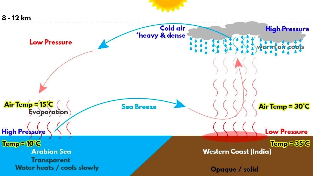
In summary, India is densely populated because its soil is very fertile, and it is fertile because of the heat and humidity.
- The heat comes from its subtropical location.
- The humidity comes from the monsoons.
- The monsoons, in turn, are caused by the fact that Eurasia is so large and the Indian Ocean lies just south of it.
Within India, the Ganges River valley is particularly fertile because:
- The monsoon winds are blocked by the Himalayas, causing rain to fall and forming rivers that can irrigate the region.
- They also carry sediment with them, which fertilizes the soil.
- It is a valley where all these waters and sediments converge because the weight of the Himalayas causes it to slope downward relative to the region farther south.
In summary, all of this is caused by the Indo-Australian Plate colliding with the Eurasian Plate. That is what causes the monsoon and the Himalayas, which together make India fertile.
OK, we’ve explained 1.4 billion people with a single geological event. But what about the rest?
2. Pakistan, Bangladesh, and Nepal
This is the same story!
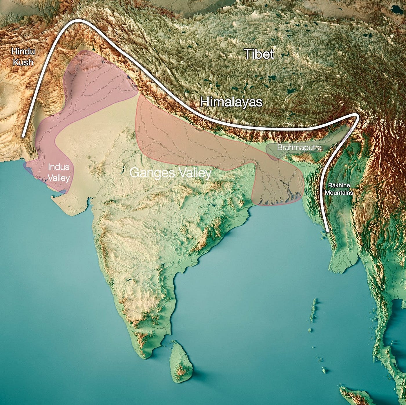
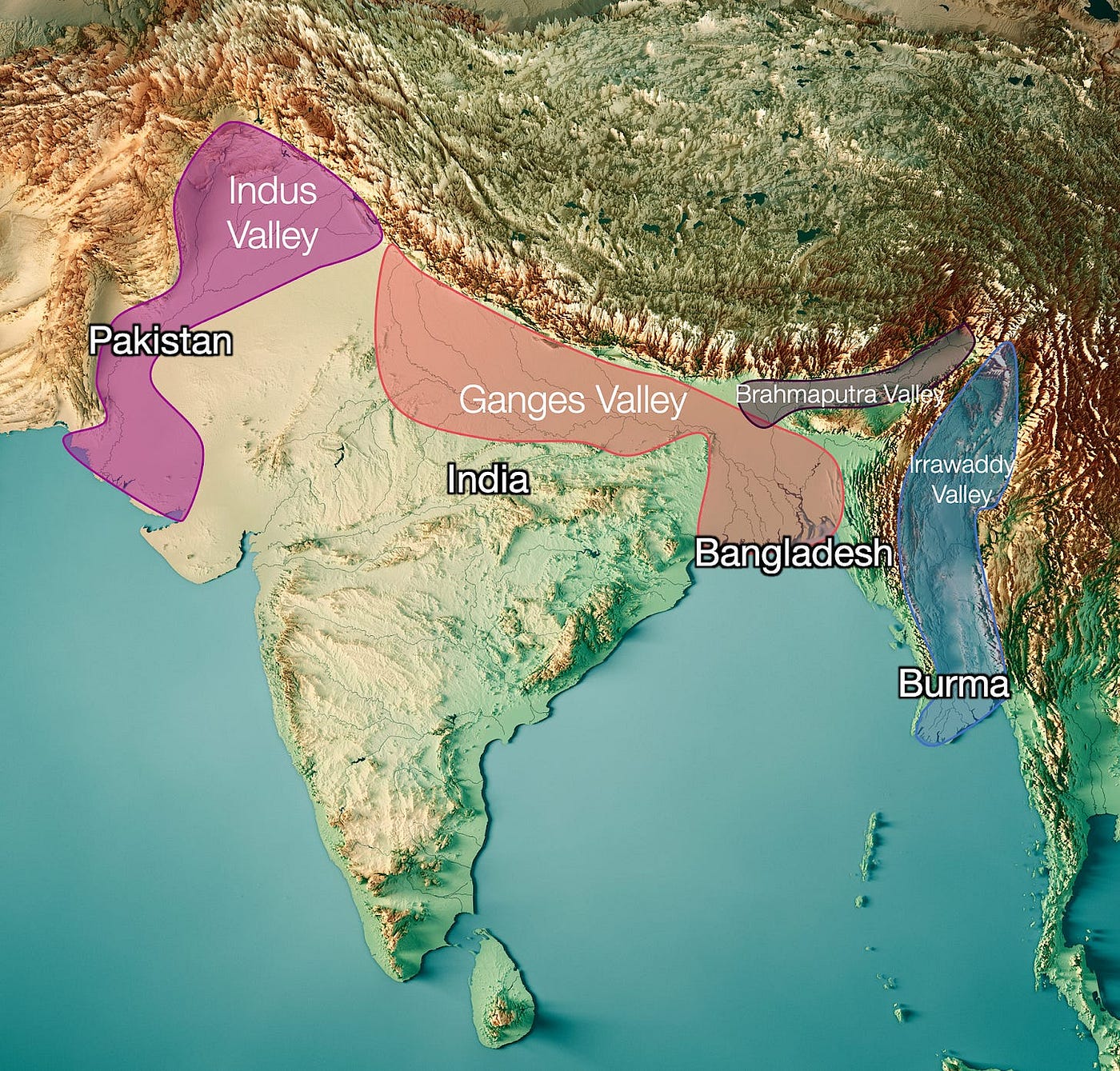
Pakistan consists mostly of the Indus Valley. Compare where Pakistanis live with the Indus River basin:
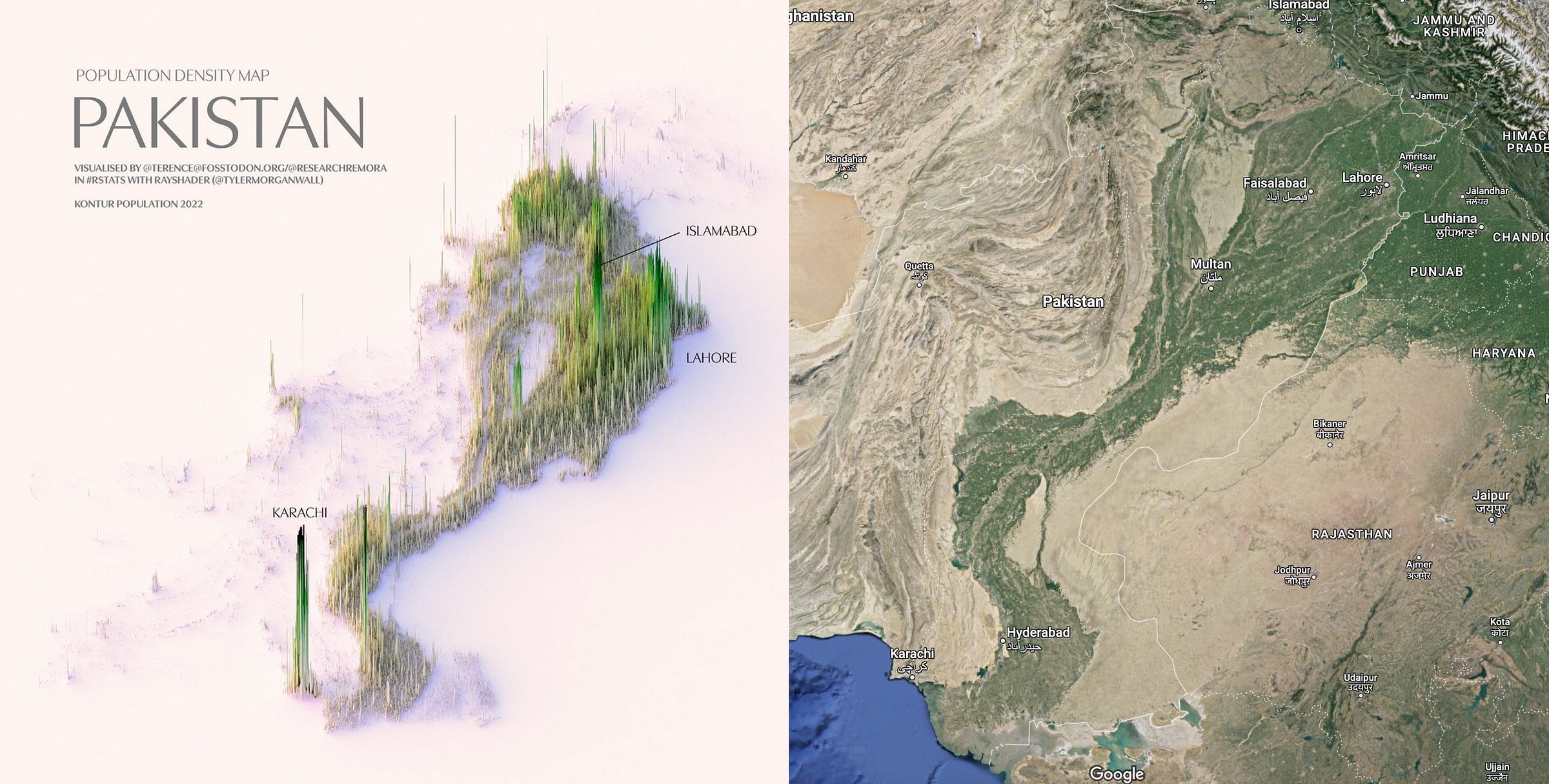
In other words, the story of the Ganges is the same for the Indus River, which means it’s the same for Pakistan: The population emerged as a result of the collision between the Indo-Australian Plate and the Eurasian Plate, which created mountain ranges (in the case of Pakistan, the Himalayas and the Hindu Kush) and the monsoon.
And the story of Bangladesh, of course, is the same as that of the Ganges, since Bangladesh is simply the mouth of the Ganges, which joins the Brahmaputra within the country.
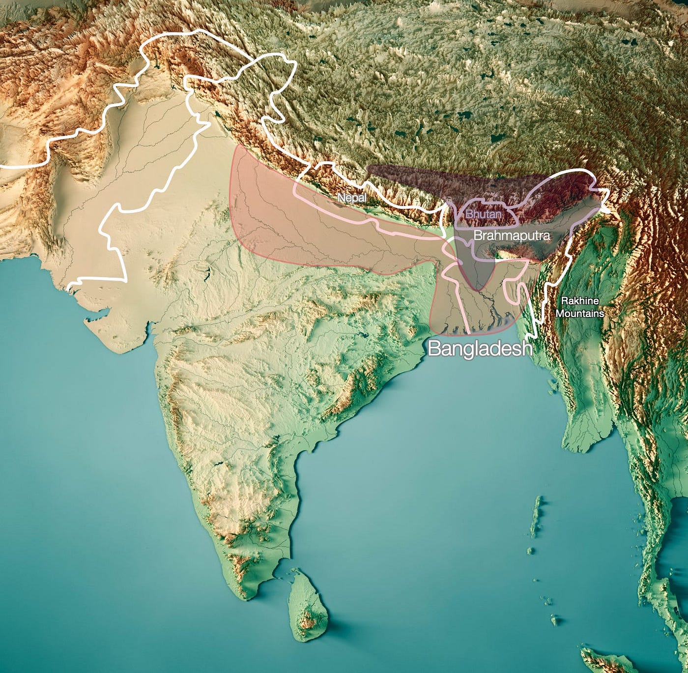
Meanwhile, Nepal is just like India: Its entire population is concentrated in the Ganges Valley, and hardly anyone lives in the Himalayas:
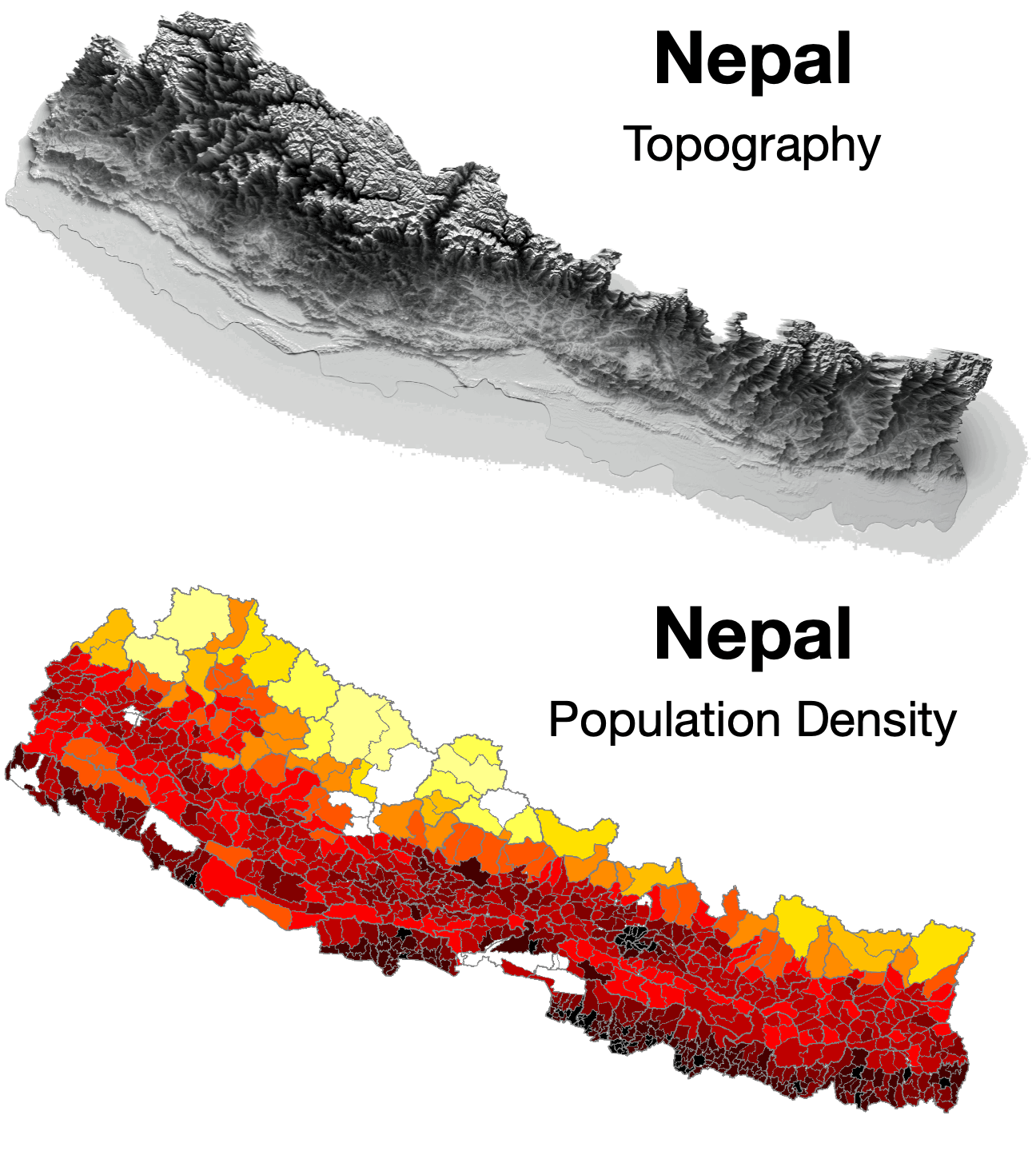
Thus, the presence of 1.8 billion people living on the Indian subcontinent can be explained by the impact of the Eurasian and Indo-Australian tectonic plates.
What about China?
3. China
In What China Wants, I took an in-depth look at how China’s geography shaped its history. Skip this section if you’re already familiar with the story. If not, here’s the short version:
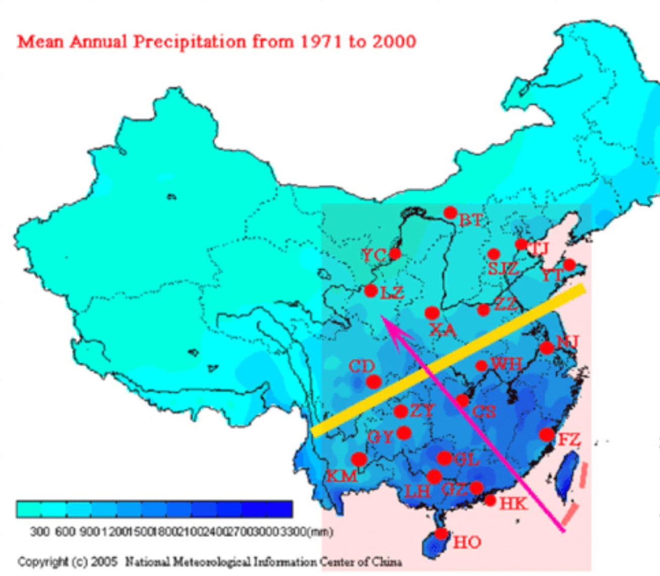
94% of Chinese people living east of the Hu Line:
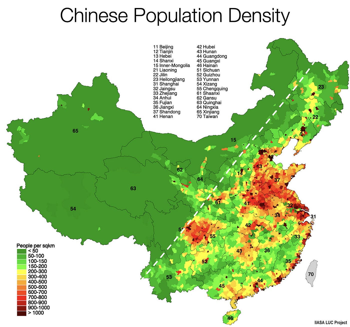
And notice where: In the large red area along the coast, a circle in the middle (the Sichuan Basin), and along the coast. You can see these plains clearly here:
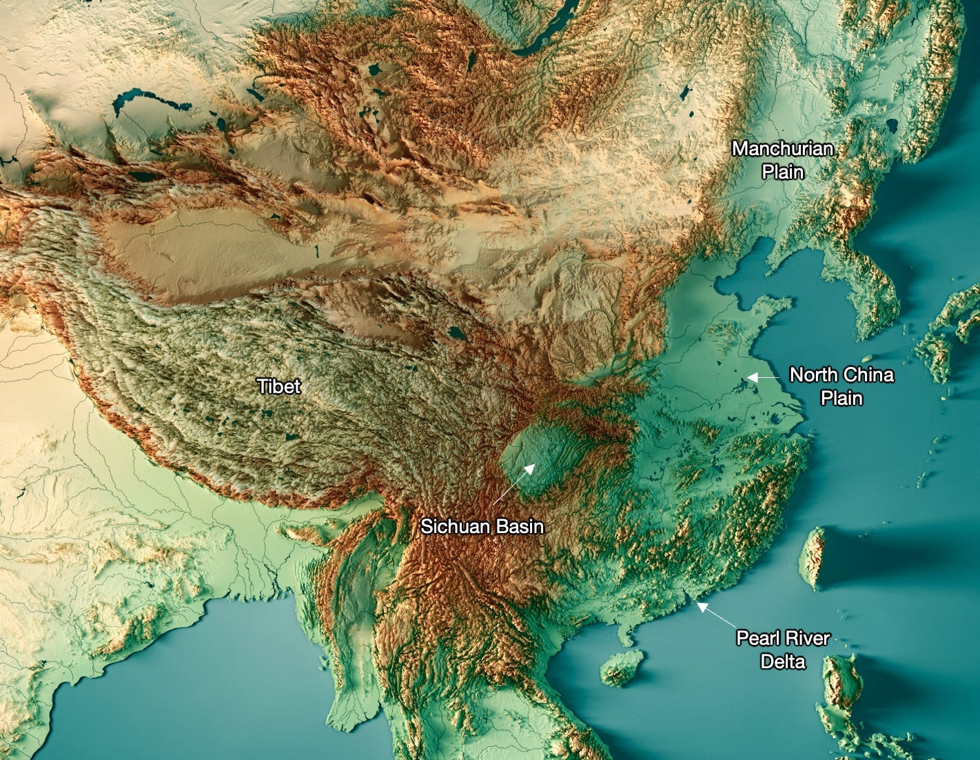
Unsurprisingly, these plains are the most fertile.
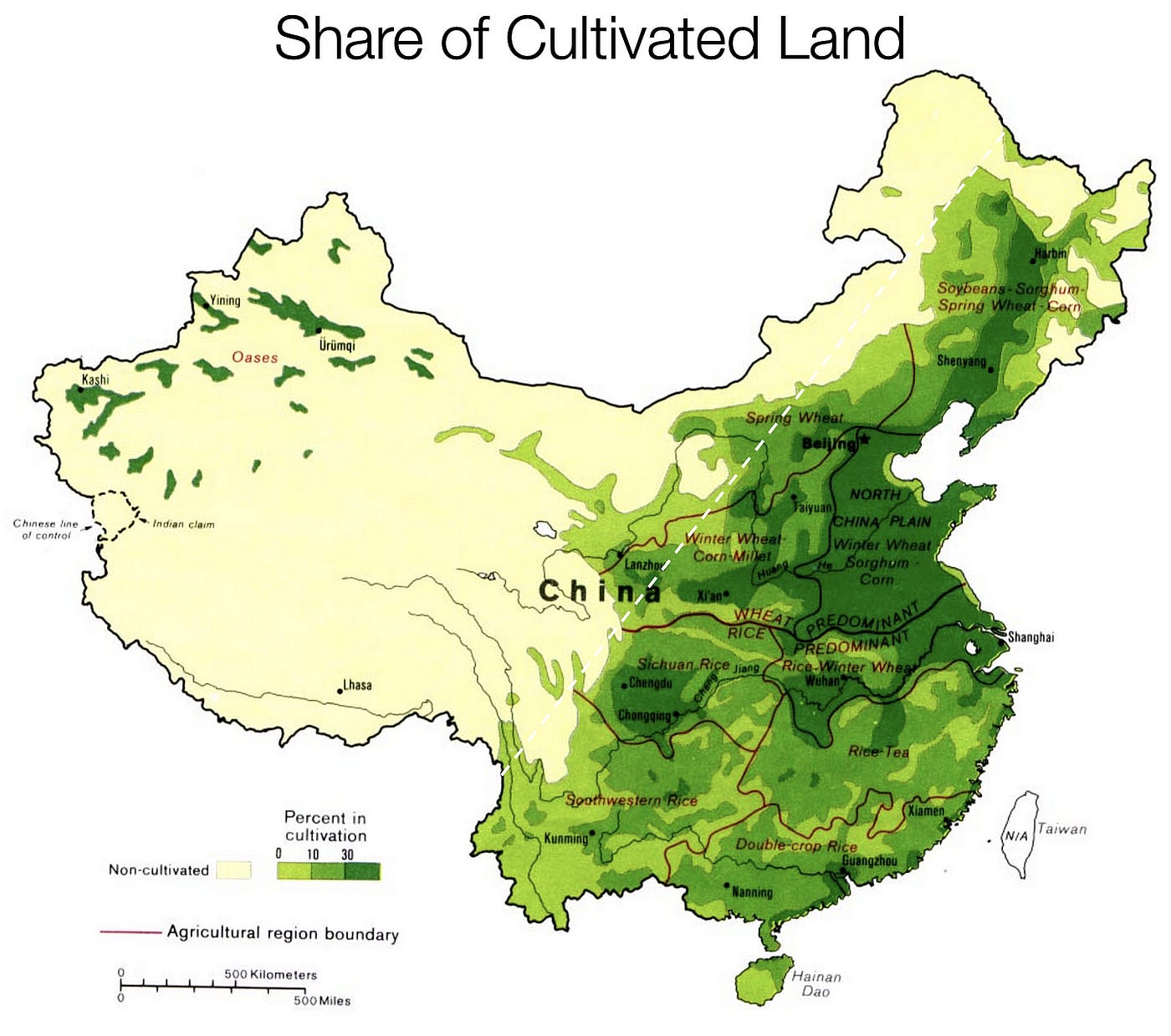
Why? Because they have what it takes:
- Temperate climate
- Flat
- Fertilized and irrigated by rivers
- Humid
They are nourished and irrigated by the Yellow and Yangtze Rivers (and, to a lesser extent, the Pearl River and smaller rivers).
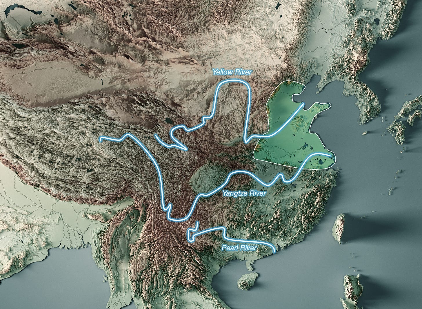
Obviously, these rivers all originate in Tibet and the surrounding mountains, most of which were formed by the collision between the Indo-Australian Plate and the Eurasian Plate.
They’re humid because of the rivers and… because of the monsoon! Which also affects China, for the same reasons as India: Eurasia is a large landmass, air rises in the summer, and moist winds from the sea sweep across the country and bring rain.
And they're flat because… well, because the Pacific Plate is colliding with the Eurasian Plate!
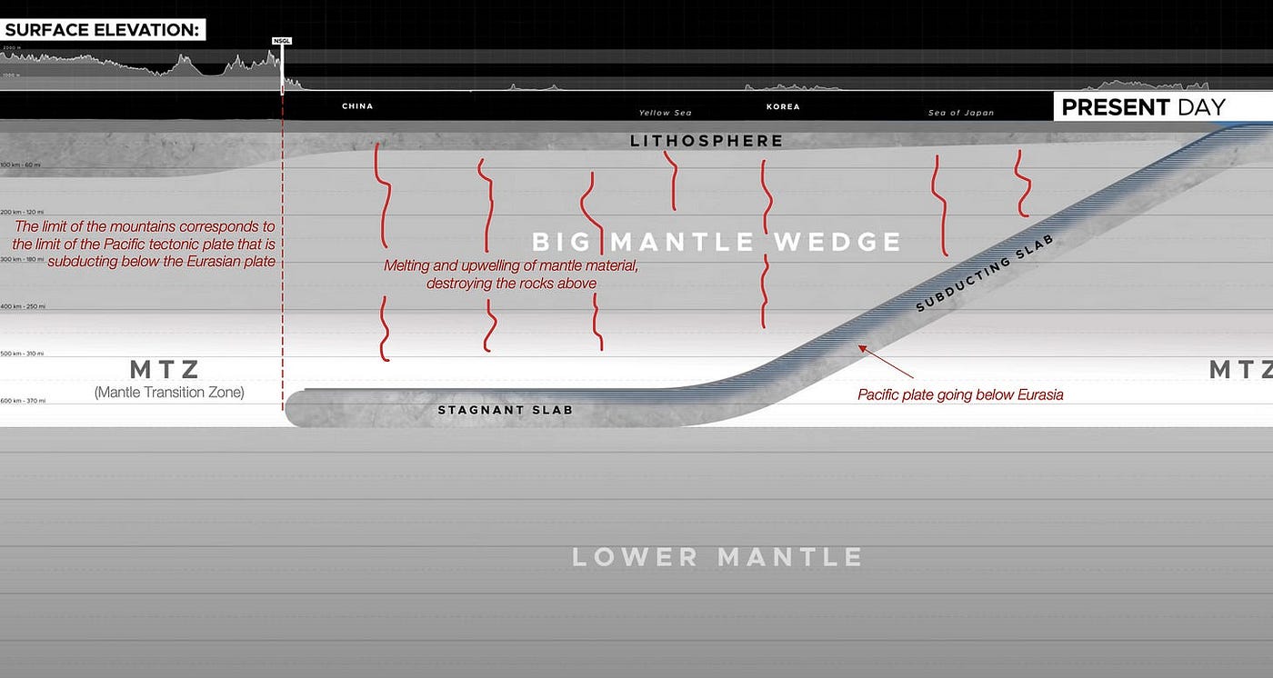
In other words, you can trace all the reasons why China is fertile (and therefore populous) back to the way the Indo-Australian and Pacific plates subduct beneath the Eurasian Plate!
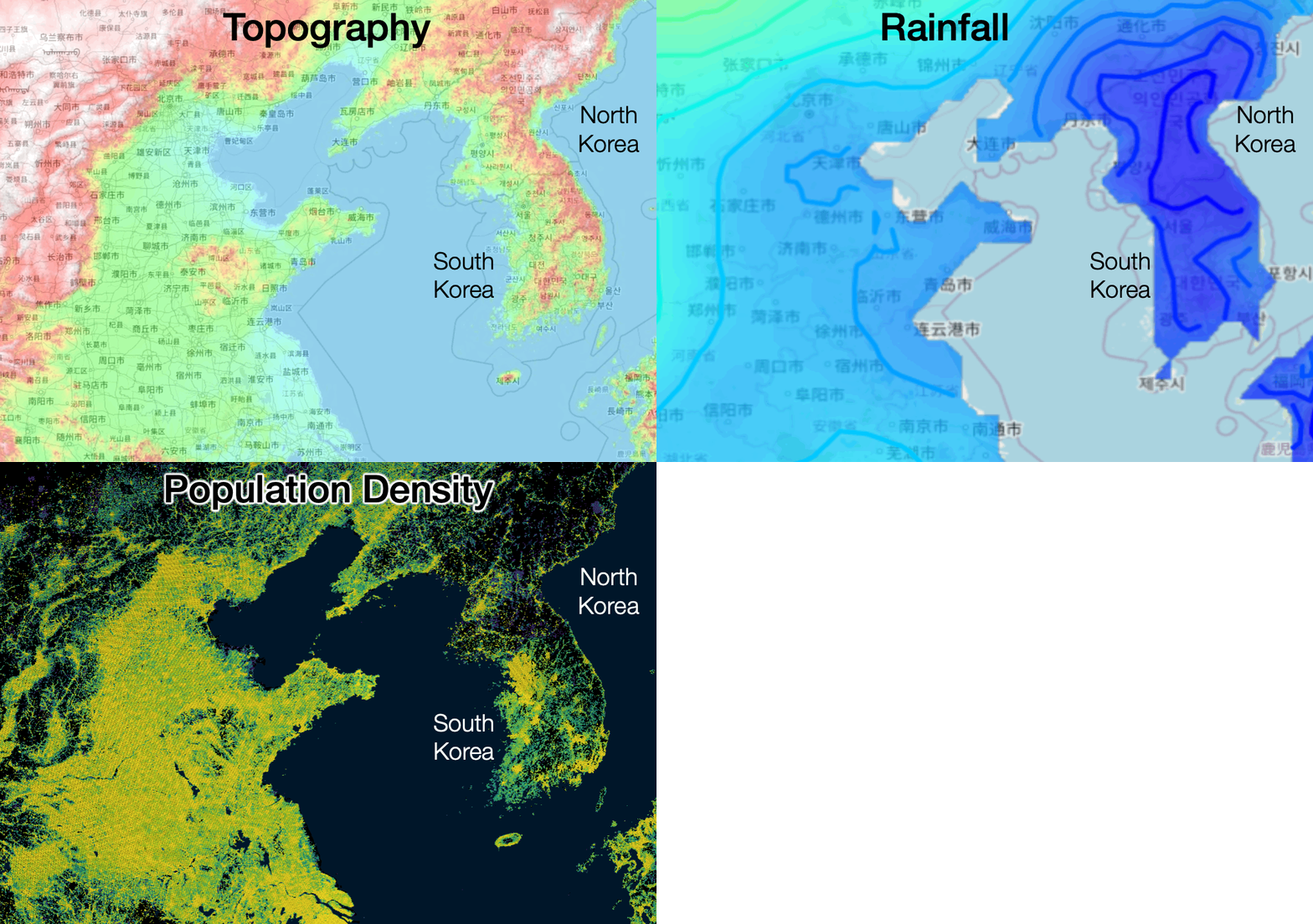
And the same logic applies to the two Koreas: Their flat valleys are densely populated because they are very fertile, thanks to the monsoons and the sediment carried down by the rivers.
4. Indochinese Peninsula
By now, you’ve probably noticed a pattern… That’s right! The same is true for the rest of mainland Southeast Asia. All of its major rivers originate in the Himalayas, Tibet, or the other mountain ranges formed by the collision between Eurasia and Indo-Australia.
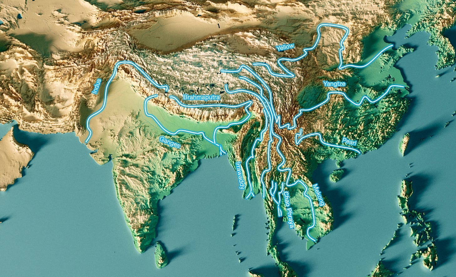
Each of the largest countries in this part of the world is centered around the major rivers fed by the Himalayas:
- Pakistan in the Indus Valley
- Northern India, mainly around the Ganges
- Bangladesh along the Ganges and the Brahmaputra
- Burma Along the Irrawaddy River
- Thailand Around the Chao Phraya River
- Vietnam, Thailand, and Cambodia in the Mekong region
- Northern Vietnam around the Red River
- China around the Yellow, Yangtze, and Pearl Rivers

These are the major river basins in East Asia.
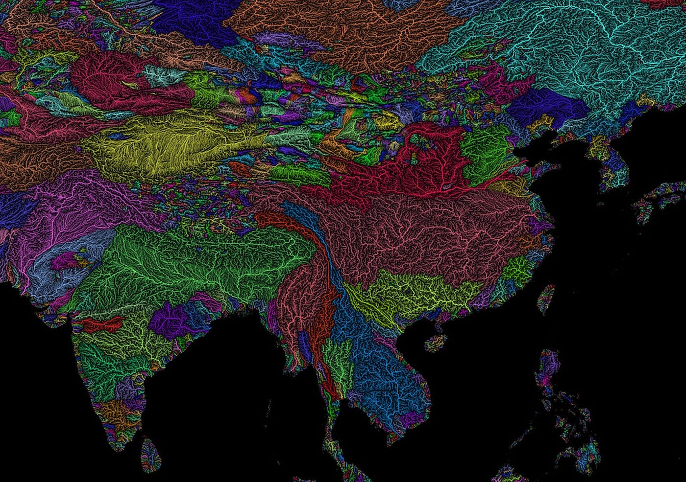
It’s no coincidence that these rivers flow through these countries. These rivers created these countries. Over millions of years, they carved out valleys, and these valleys—protected by mountain ranges—have each provided fertile ground for a different civilization to emerge.
You can see this clearly by comparing the topography and river maps (left) with the population density map (right).

This map shows both the river valleys of Southeast Asia and their population densities. We can see that the Irrawaddy shaped Burma; the Chao Phraya, Thailand; the Mekong, Cambodia and South Vietnam; and the Red River (as well as the Cả River, not shown here), Northern Vietnam.
And so you can also trace the population of Southeast Asia back to the same root cause:
- The collision of the Eurasian and Indo-Australian plates created all these rivers.
- The rivers, in turn, carve out valleys, level them, fertilize them, and irrigate them.
- These regions are also warm because of their latitude, and humid because of the same monsoon that affects India and China—a monsoon caused by the same winds resulting from the same plate tectonics.
- These conditions created the fertile environment necessary for such a large population to thrive along the rivers of Southeast Asia
5. Asian Islands
So far, we’ve explained the population of southern and eastern continental Asia using the same principles of plate tectonics: Eurasia’s massive size and its collision with the Indo-Australian and Pacific plates. But of course, that can’t apply to the islands, right? Indonesia, Japan, and the Philippines are home to more than 500 million people, but they can’t be supplied by rivers that originate in Tibet.
No, but they’re still caused by the same plate tectonics!
In Why Is Java So Weird?, I explained the origin of Java's population.
The short version is that Java accounts for 55% of Indonesia’s population because of its volcanoes, which make the island extremely fertile.
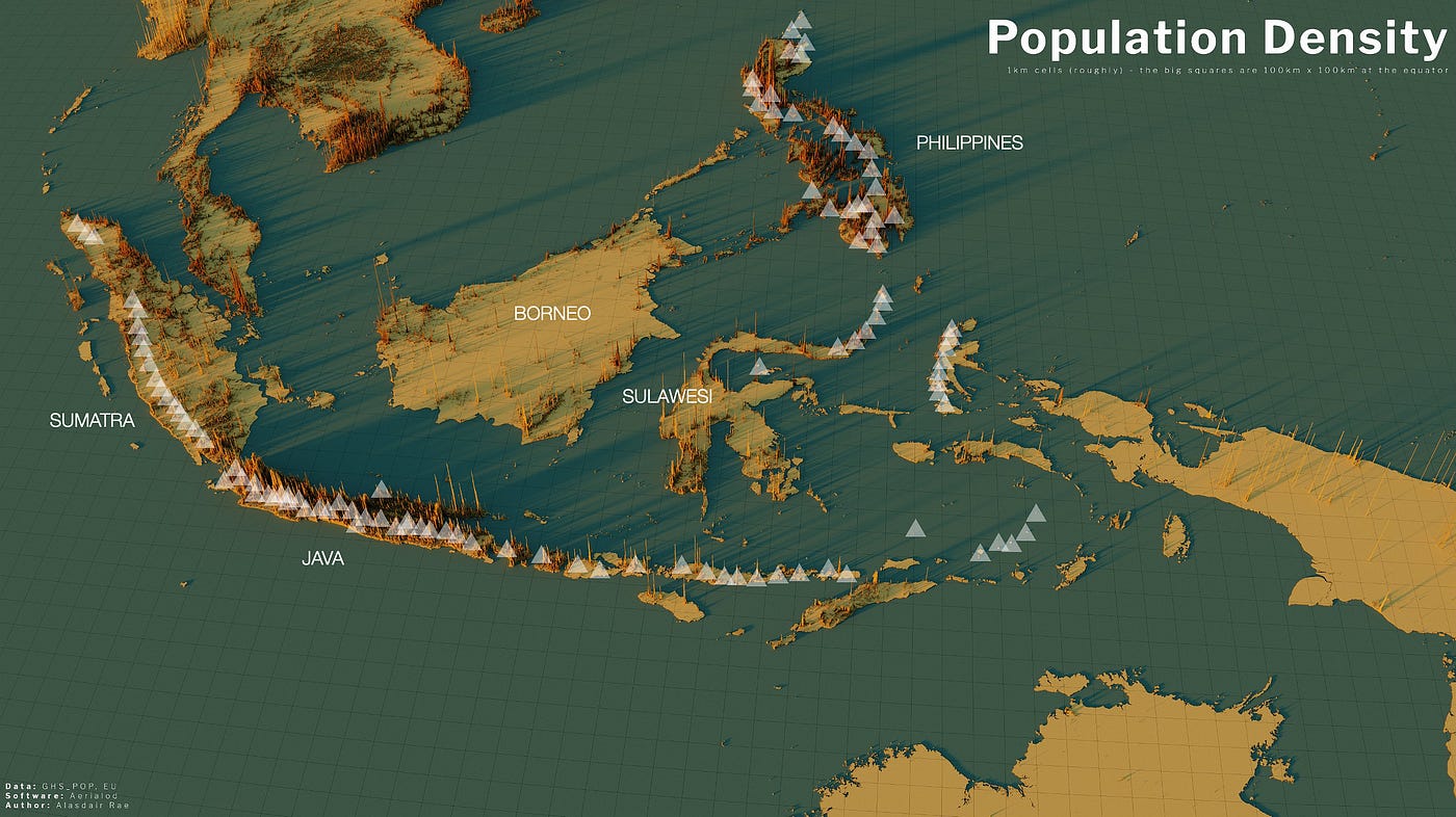
But this isn't just true for Java. It's true for most of Indonesia: Generally, the most fertile areas are those with the most active volcanoes.
And guess what causes volcanoes?
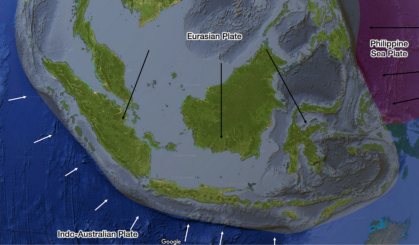
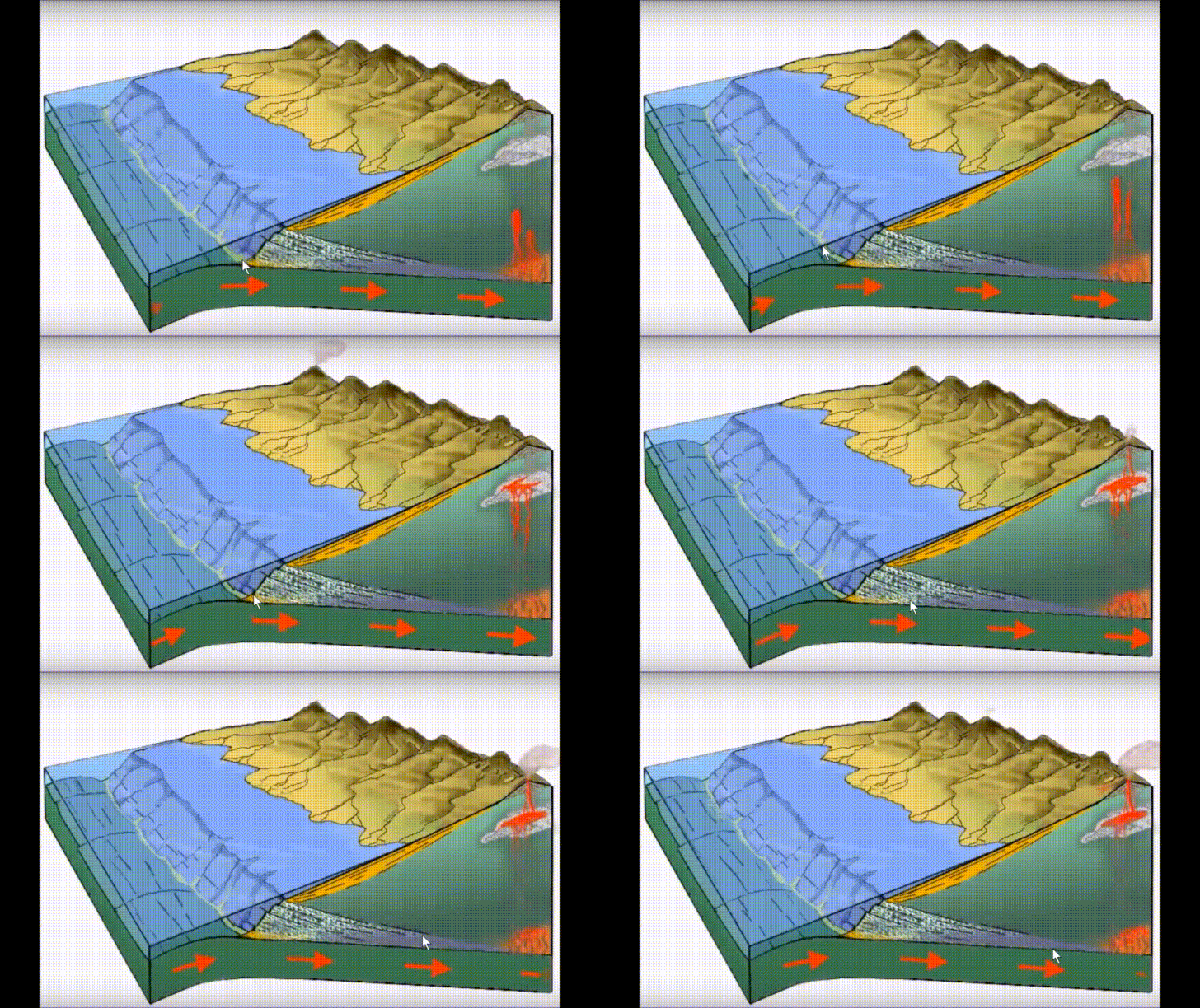
That's right! Our beloved Eurasian Plate is colliding with the Indo-Australian Plate! This is how volcanoes are formed:
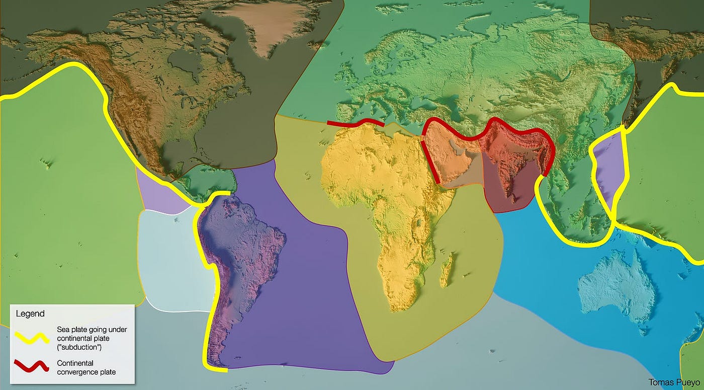
A reminder on the plates:
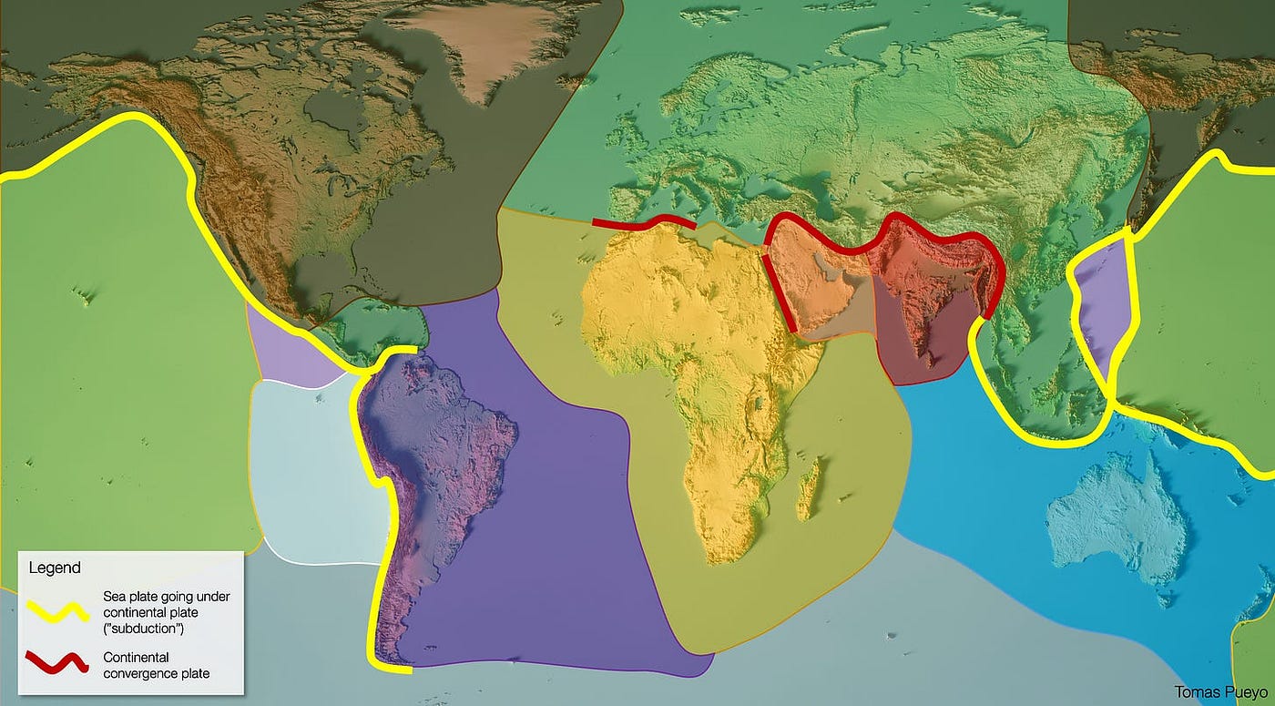
So yes, a large portion of Indonesia’s population is also created by the collision of the Indo-Australian and Eurasian plates!
Oh, but what do you see just northeast of Indonesia? The Philippines! And what’s in the Philippines? Volcanoes!

And why are there volcanoes there? Because of the subduction of the Philippine Sea Plate beneath the Eurasian Plate! And what lies north of the Philippines, along the same tectonic plate boundary?
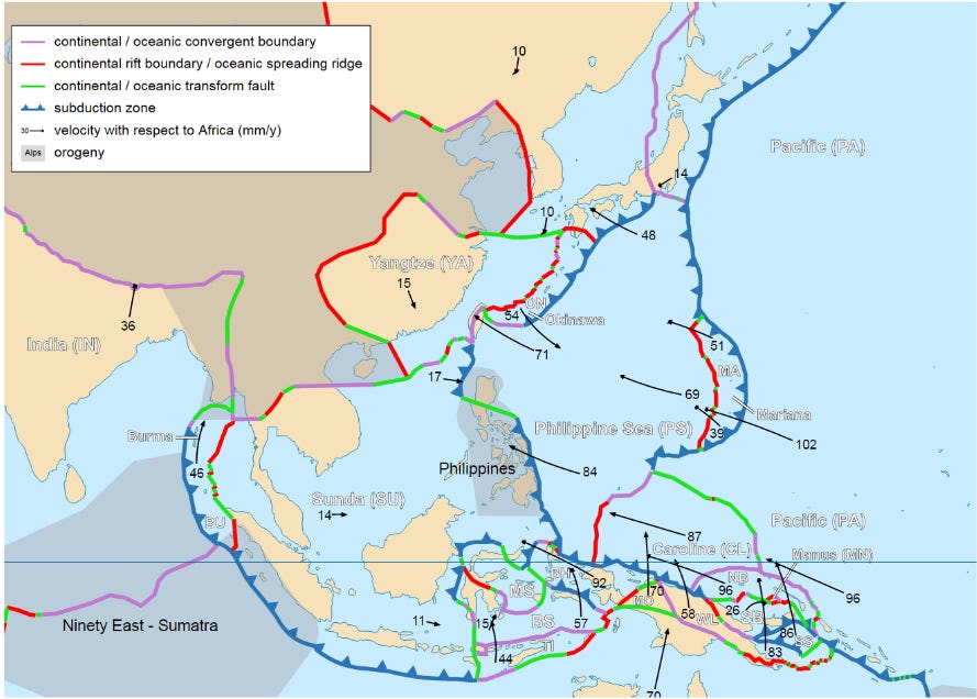
That’s right. Indonesia, the Philippines, Taiwan, and Japan share the same characteristics: They are islands formed by the collision of the Eurasian Plate with other plates (the Indo-Australian Plate, the Philippine Sea Plate, and the Pacific Plate), and their numerous volcanoes make them extremely fertile.
Conclusion: Why Is 50% of the Population in That Circle?
In summary, the reason so many people live in that area is that a massive continental plate—the Eurasian Plate—is colliding forcefully with other tectonic plates.
The collision of the Indo-Australian Plate with the continental crust created a massive mountain range, which then blocked the winds, collected their moisture, and distributed it among many different rivers, each of which gave rise to a civilization.
Where the Eurasian Plate collides with oceanic crust, the oceans subduct beneath the Eurasian Plate, creating volcanic arcs with hyperfertile soil that give rise to more civilizations. This occurs in:
- The Indo-Australian Plate at the level of Indonesia
- The Philippine Sea Plate and the Philippines
- The Pacific Plate and Japan
Because all these collisions occur near the equator, close to the oceans, all these regions are hot and humid. And since the Eurasian Plate is so large, it generates monsoons that draw even more moisture inland.
There’s only one question left: Why is the Eurasian Plate colliding so violently with three other plates?
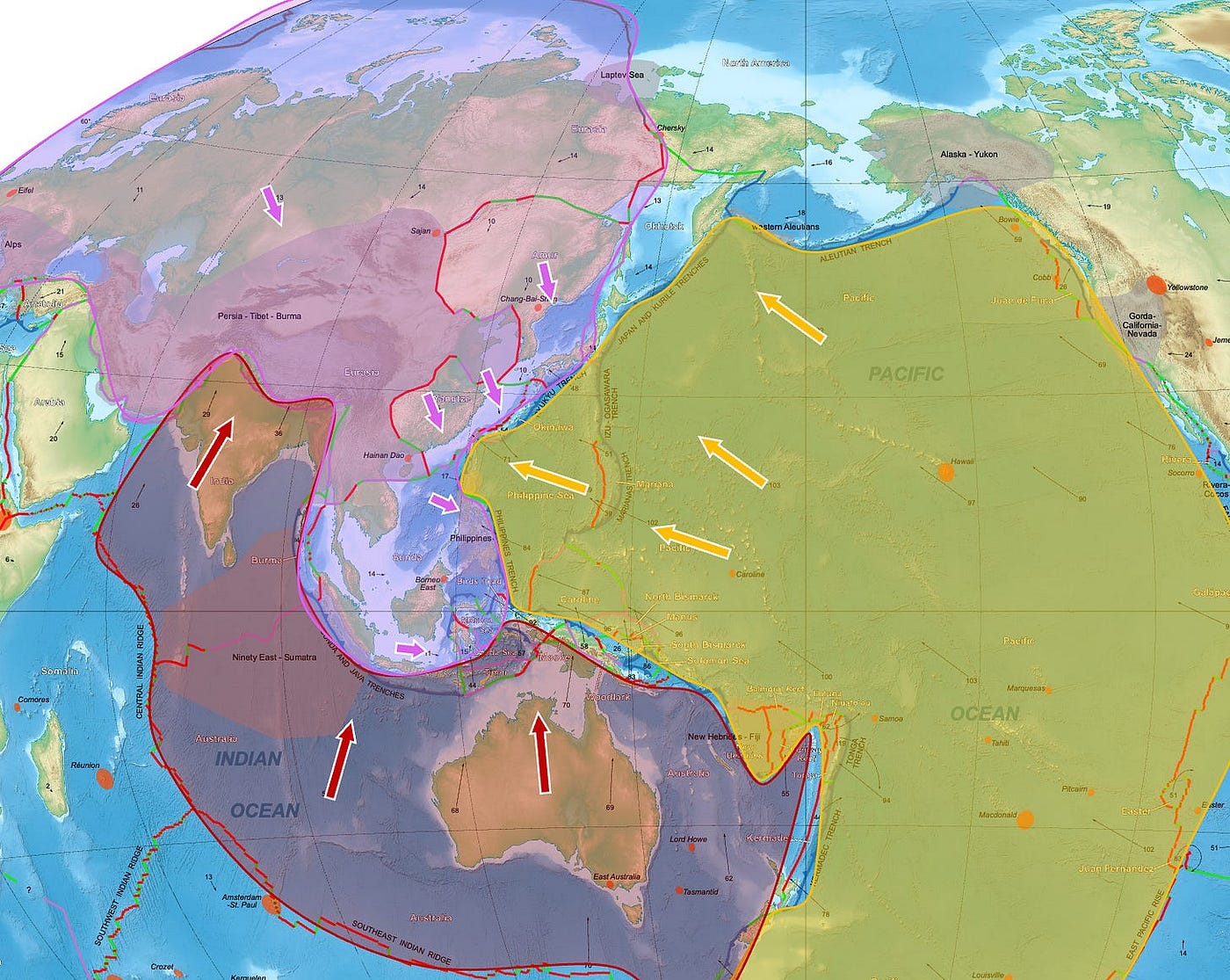
While the Eurasian Plate is rotating clockwise and moving southeast along its eastern edge, the Indo-Australian Plate is moving northward, while the Pacific Plate, together with the Philippine Sea Plate, is moving rapidly westward.
This is like a three-way head-on train crash.

Except that this one created half of all human life on Earth.
If you're interested in how the world works—and especially in how the shape of the Earth continues to influence us today—subscribe to receive my emails! Scroll down until you see my name, then click on the little envelope to the right.