





For centuries, roads have shaped the landscape and economic development of Martinique. Yet their history and impact remain largely unknown to the general public. The book Martinique’s Road Network – From Colonial Roads to National Highways, signed by Gérard Théodose and Yves-Marcelle Richer, aims to fill this gap. Through meticulous research and a wealth of illustrations, it traces the evolution of the island’s road infrastructure and highlights its central role in the organization of Martinique’s territory.
A MUST-HAVE BOOK YOU'LL FIND IN EVERY BOOKSTORE
From Colonial Roads to National Highways: A History of Transition
Until 1951, Martinique’s roads were part of the colonial network. The decree of July 8 of that same year marked a turning point by incorporating most of this infrastructure into the French state’s domain. Since then, these roads, which have become national highways (RN), have undergone major improvements to meet the growing needs of an increasingly mobile population. Today, they are a vital link in the island’s development, facilitating economic exchange, daily commutes, and urban development.
But beyond their purely utilitarian function, Martinique’s roads are also witnesses to history. Many of them still follow the routes established during the colonial era, reflecting a spatial organization inherited from that time. This book explores this historical continuity, highlighting the influence of colonization on the distribution of infrastructure and the consequences that are still felt today.


An essential but unevenly distributed network
One of the book’s strengths lies in its in-depth analysis of the characteristics of Martinique’s road network. With only 320 kilometers of national highways—less than 10 % of the total road network—Martinique has a limited but structuring network. This network is characterized by a star-shaped layout centered on Fort-de-France, a direct legacy of the colonial period. This centralization, coupled with the island’s demographic and economic growth, has led to congestion on the main thoroughfares and recurring traffic jams, particularly during rush hour.

The book also highlights the disparities among the various national highways. Some, such as the A1 highway connecting Fort-de-France to Le Lamentin, are vital to the local economy, serving the main industrial and commercial areas. Others, such as the RN2, which runs along the rugged coastline of the Northern Caribbean, are more difficult to access and subject to the vagaries of the weather.

A heritage to preserve and modernize
Beyond technical and historical analysis, Martinique’s Road Network – From Colonial Roads to National Highways calls for a broader reflection on the concept of road heritage. While there is often talk of preserving architectural or cultural heritage, road infrastructure—despite being essential to the daily lives of Martinicans—is rarely viewed from this perspective. The book highlights the importance of preserving the history of roads—particularly through the engineering structures that comprise them—while emphasizing the need to adapt this infrastructure to the challenges of the 21st century.
The book also addresses the issues of public transportation, sustainable development, and reducing dependence on cars. As Martinique faces growing challenges in the areas of mobility and land-use planning, this book provides valuable insight into the current and future challenges facing the island’s national highways.
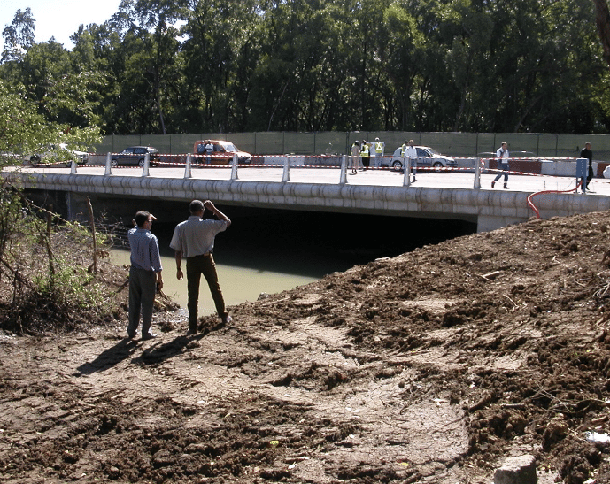
An essential book for understanding Martinique today
Drawing on the expertise of Gérard Théodose, who spent forty years maintaining and managing Martinique’s national highways, and on the geographical and heritage-based approach of Yves-Marcelle Richer, Martinique’s Road Network – From Colonial Roads to National Highways has established itself as an essential reference. This book offers a unique insight into the history and evolution of Martinique’s road infrastructure, while prompting reflection on the future development of the region.
A book for everyone—from history buffs to urban planning professionals, and everyone in between who travels these roads every day without knowing their history.

Yves-Marcelle Richer, a geographer dedicated to heritage preservation
Yves-Marcelle Richer is a geographer dedicated to promoting Martinique’s cultural heritage. With an interest in the various aspects of history and land-use planning, she quickly recognized the importance of the road network in shaping the island’s structure.
Through this book, she sheds light on an often-overlooked aspect: the island’s road heritage. For beyond their everyday use, Martinique’s roads reflect a rich and sometimes little-known history. Her goal? To raise public awareness of this heritage and to remind people that the memory of infrastructure is a key element of Martinique’s identity.
Gérard Théodose: A Life on the Roads of Martinique
An undisputed expert on Martinique’s road network, Gérard Théodose has devoted more than 40 years to the maintenance and development of national highways. First with the Departmental Directorate of Public Works (DDE) and later with the Regional Council, he tirelessly traveled the island’s infrastructure to ensure it remained in good condition.
Fascinated by the history and functioning of roads, he has amassed thousands of photos and gained invaluable knowledge of Martinique’s engineering structures and major transportation corridors. For him, this book is a way to share this unique knowledge and raise public awareness of the importance of these infrastructures, which are all too often viewed solely as traffic routes, without any appreciation of their historical and social impact.

SEE ALSO:
«Major Construction Projects in Martinique as Seen by Builders»